50120 postal code
MexicoUpdated 2026-11-09Ciprés, MéxicoToluca5 digits
Postal code details
6 placesCode
50120
Place
Ciprés
Region
México
County
Toluca
Coordinates
19.2668, -99.6752
Accuracy
1 / 6
Country
Mexico
Location
OpenStreetMap ↗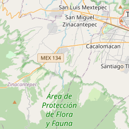

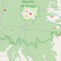

19.2668, -99.6752© OpenStreetMap
Ad slot · 300×250
Places under this code
6| Place | Region | County | Coordinates |
|---|---|---|---|
| Ciprés | México | Toluca | 19.2668, -99.6752 |
| Colón | México | Toluca | 19.297, -99.6664 |
| Federal (Adolfo López Mateos) | México | Toluca | 19.2668, -99.6752 |
| Granjas | México | Toluca | 19.2668, -99.6752 |
| Morelos 1a Sección | México | Toluca | 19.2668, -99.6752 |
| Morelos 2a Secc | México | Toluca | 19.2668, -99.6752 |
Same code in other countries
9| Country | Place | Region |
|---|---|---|
| ES Spain | Alfocea | Aragon |
| FI Finland | Mikkeli | Southern Savonia |
| FR France | Cherbourg-en-Cotentin | Normandie |
| KR South Korea | 가북면 | 경상남도 |
| LK Sri Lanka | Galkiriyagama | North Central Province |
| PK Pakistan | Chak Muhammad | Punjab |
| PL Poland | Wrocław | Lower Silesia |
| TH Thailand | San Pa Tong | Chiang Mai |
| US United States | Haverhill | Iowa |
FAQ
Which city is 50120 in?
Ciprés, México, Mexico.
What are the coordinates of 50120?
19.2668, -99.6752
Is 50120 used in other countries?
Yes, 9 other countries.
Updated 2026-11-09. Attribution in Data & license.